Death Valley can be a furnace in the summer, but my wife, Pat, and I enjoyed comfortable temperatures during our January visit, with nighttime lows of 25-30°F (-4 to 0°C) and daytime highs of 65-70°F (18 to 21°C). The park's varying elevations allowed us to see the snow-capped Panamint Range in the distance. We stayed for two nights at the historic Inn at Death Valley, which had a convenient refrigerator in our room. While there are inns and motels in nearby Beatty, NV, we opted not to stay there.
Death Valley is a land of extremes. This below-sea-level basin is known for its consistent drought and record summer heat. It’s famous for being the hottest place on Earth and the driest location in North America. Furnace Creek holds the world record for the highest air temperature ever recorded, reaching 134°F (57°C) on July 10, 1913. During the summer, temperatures often exceed 120°F (49°C) in the shade, while overnight lows can drop into the 90s°F (mid-30s°C). 
We spoke with a Park Ranger about the extreme summer temperatures. She explained that there can be a significant difference between ground temperatures and those at eye level.

©sabino.parente/Adobe

The temperature difference between ground and air can range from 30 to 60 degrees Fahrenheit (17 to 33 degrees Celsius). For example, on July 15, 1972, Furnace Creek recorded a ground temperature of 201°F (94°C) while the air temperature reached 128°F (53°C). This means the ground was 73°F hotter than the air, highlighting a serious warning for summer visitors.
Springtime is the busiest time to visit Death Valley National Park, especially in March and April. This is also when the weather is at its best, with warm days and cool nights, and there’s also a chance to see spring wildflowers if there has been enough rain. The U.S. National Park Service says that the park can get very crowded during the spring break, with lodging and campgrounds often fully booked, making it necessary to reserve accommodations months in advance. January and February are good months to visit, with average high temperatures of 67°F (19°C) and lows of 40°F (4°C) in January, and even warmer temperatures in February, averaging 73°F (23°C) during the day and 46°F (8°C) at night.
Death Valley National Park is an excellent destination for photographers and adventurers wanting to experience a mind-bending landscape filled with sand dunes, salt basins, and stunning views.
Quick Tips logo
When planning a visit to Death Valley, it is important to:
• Check road conditions and closures with the National Park Service
• Be sure your vehicle is appropriate for the terrain you plan to travel on
• Pack plenty of water, food, and other essentials, as services may be limited in some areas
• Let someone know your route and expected return time

• Pets, even if carried, are not allowed on the dunes or any trail in Death Valley National Park
• Do not leave your animal in your vehicle
• Speak with a ranger about one of the incredible dirt roads where you may walk your pet
• Check the NPS Weather page for monthly averages
Travling by Car (latest info on gas stations and EV chargers)
Park Map (Online and printable, showing roads and park destinations)
___________________________________________________
Zabriskie Point
Our first stop was Zabriskie Point, where we pulled into the designated parking area. There were plenty of available spaces. The sight was breathtaking, especially in winter, with the snow-capped Panamint Range and the colorful hills and formations. It was about an hour before sunset on a cloudy, cool afternoon. We quickly realized that the sunset wouldn’t be particularly impressive. Nonetheless, the rolling hills, canyons, and vibrant colors were still remarkable. One of the notable features of this area is Manly Beacon, a prominent high point that rises to an elevation of 823 feet (251 meters). This point is named after one of the first 49ers, the gold rush pioneers, who visited the area.

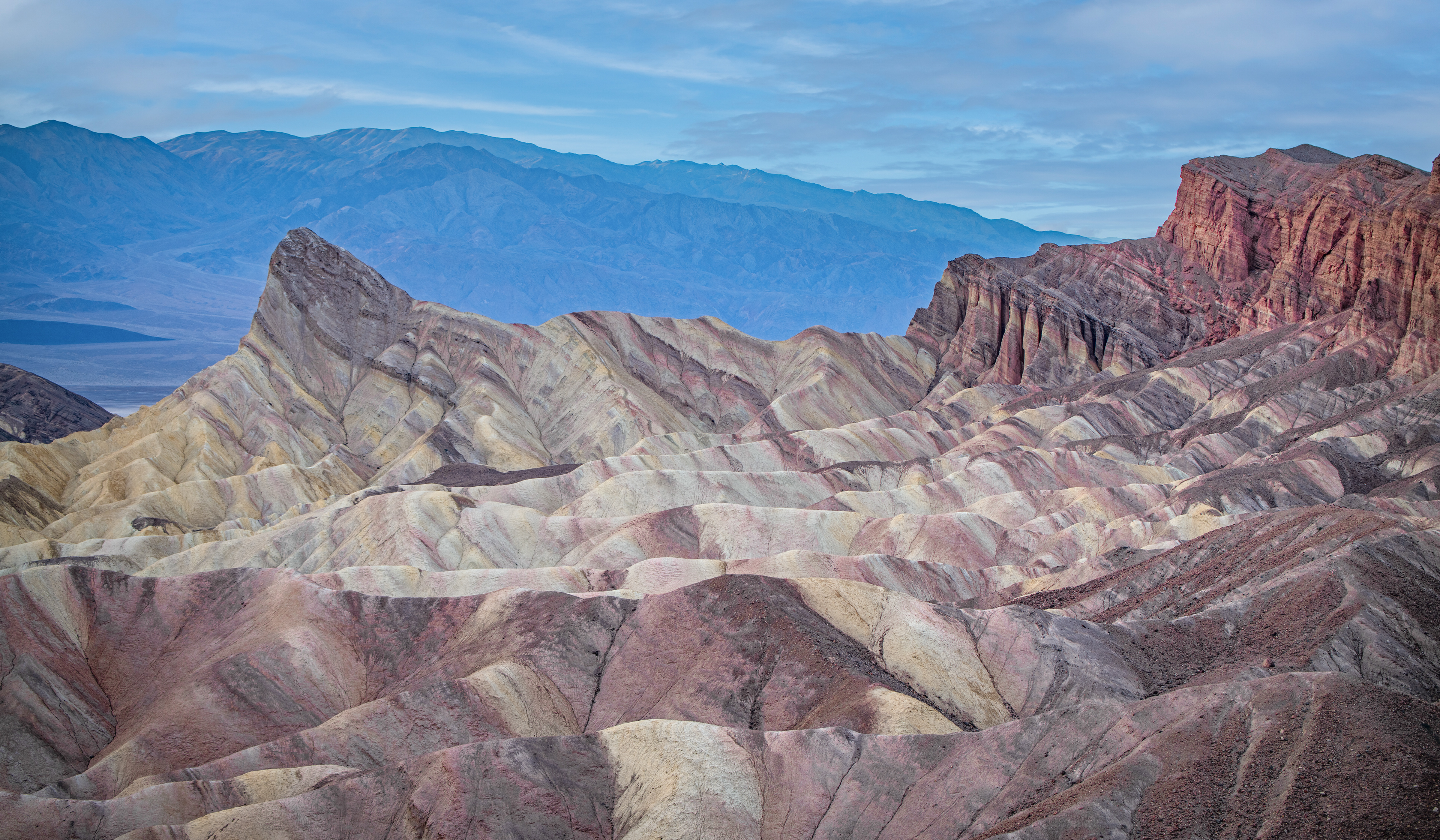
Manley Beacon juts out of the remarkable landscape at Zabriskie Point. ©Tom Dorsz

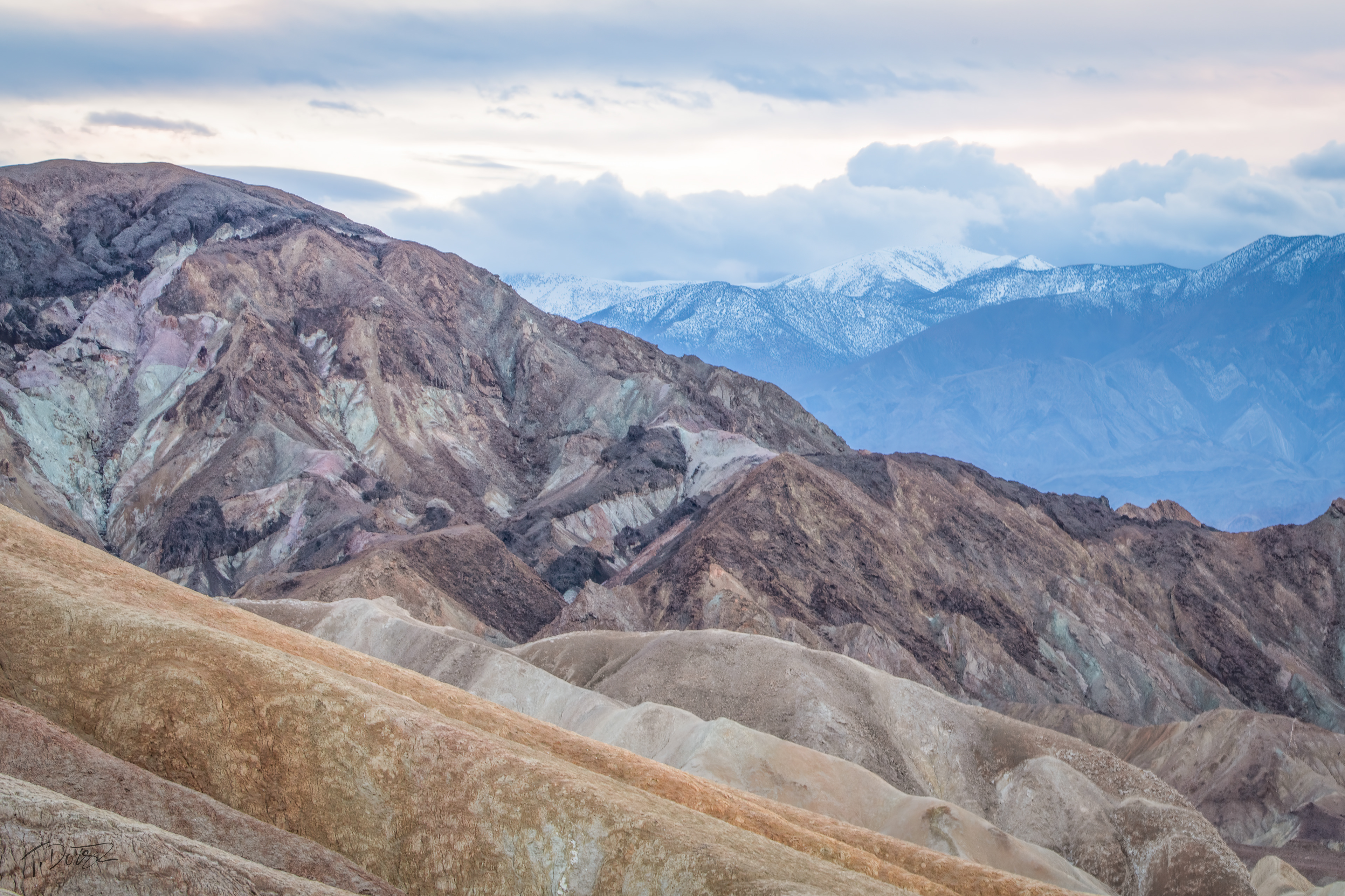
The snow-capped Panamint Range is seen from the stunning yellow and brown-striped hills and jagged badlands of Zabriskie Point. ©Tom Dorsz

The sand-colored badlands of Zabriskie Point are impressive and visible from the parking lot. If you're young and in good shape, you can also hike the trail shown at the bottom of this photo. ©Tom Dorsz

Watching hikers navigate the challenging trails at Zabriskie Point in the Badlands. ©Tom Dorsz

___________________________________________________
Dante's View
We woke up before sunrise and drove to Dante's View, which is about a 45-minute drive up a winding road from the Inn at Death Valley. The parking area and viewpoint are about 3,000 feet from the 5,475-foot summit of the Black Mountains. When we arrived, the sun was just beginning to rise above the horizon. It was a chilly morning, with temperatures just below freezing at this elevation.
The sweeping view includes Badwater Basin's salt flats, the lowest point in the contiguous United States, and the towering Panamint Range. We ran into other photographers who had set up their tripods at the edge of the viewpoint. They give you a good perspective on the vastness of the scene.
Hiking Opportunities: While the main viewpoint is easily accessible, there are hiking trails along the ridge, providing a challenging hike further to explore the expansive views to the north and south.

There's no wind, no sound but an incredible view. ©Tom Dorsz

The sun peeks over the horizon and lights up Badwater Basin. ©Tom Dorsz

Looking across Badwater Basin and its salt flats to the Panamint Range from Dante's View just before sunrise. ©Tom Dorsz

___________________________________________________
Mesquite Flat Sand Dunes
The Mesquite Flat Sand Dunes are the most popular dunes in the park because parking is convenient. These easily reachable dunes near Stovepipe Wells are a favorite for photographers, hikers, sandboarders, and anyone who appreciates the landscape's immensity. While there is no official trail, the hike to the tallest dune and back to the parking lot is about two miles and takes about an hour and a half. 
The Sand Dunes here are perfectly formed due to several natural factors. First, there needs to be a source of sand, which in this case comes from the eroding Amargosa Mountains to the north. Next, wind is needed to move the sand, and finally, there must be a barrier to prevent the sand from blowing away, and that is the Panamint Mountains to the south.
The name "Mesquite" originates from the small green mesquite trees that grow there. These trees thrive in the harsh sandy environment and produce beautifully gnarled wood. They offer shelter from the sun for various desert creatures, including kangaroo rats and sidewinder rattlesnakes. The presence of rattlesnakes alone is a good reason to keep your distance from the mesquite trees, whether dead or alive!

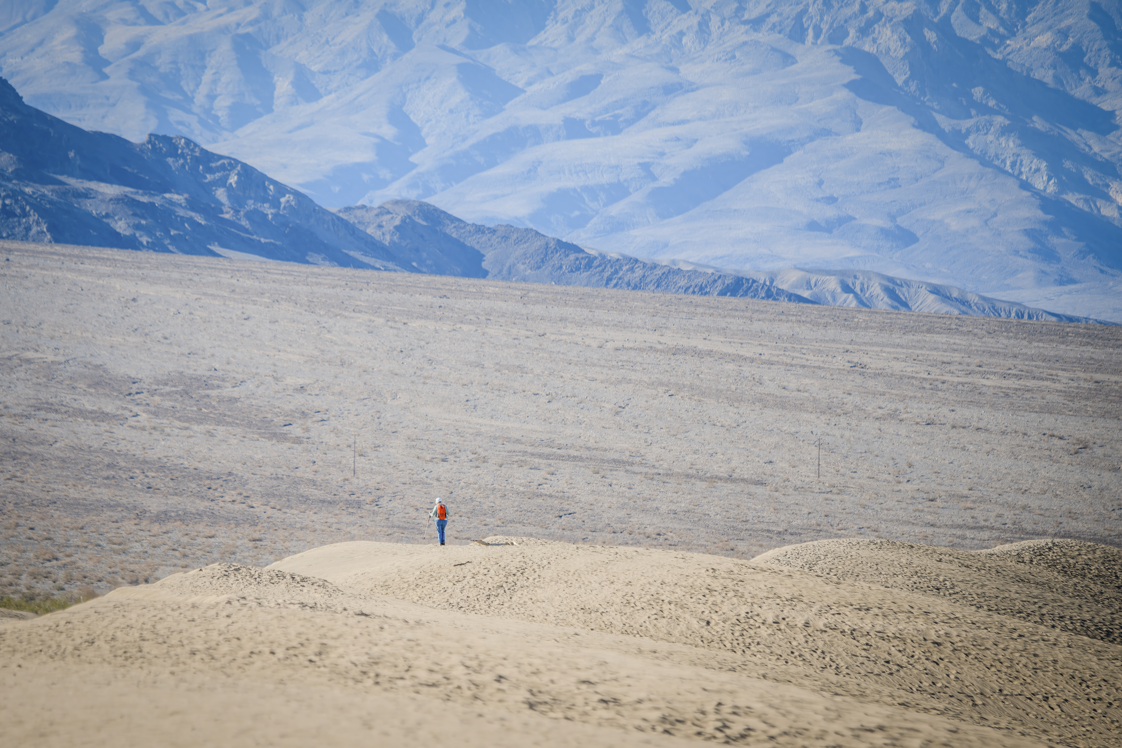
Pat stood at the edge of the dunes, taking in the immense scene. The ground here is more compact than the drifting sands of the dunes, but what is truly amazing is the vastness of the landscape. ©Tom Dorsz

The early morning sunlight shines over the dunes and mountains at Mesquite Flat Sand Dunes in Death Valley National Park, California. There are walking paths along the dunes. The footprints will remain until it either rains or the wind blows the sand into new formations. It's very important to be in excellent physical condition to climb up and down the dunes. ©Tom Dorsz

Green mesquites grow among the dunes near the dry and desolate Panamint Mountains, which serve as a barrier to help hold the sand in place. ©Tom Dorsz

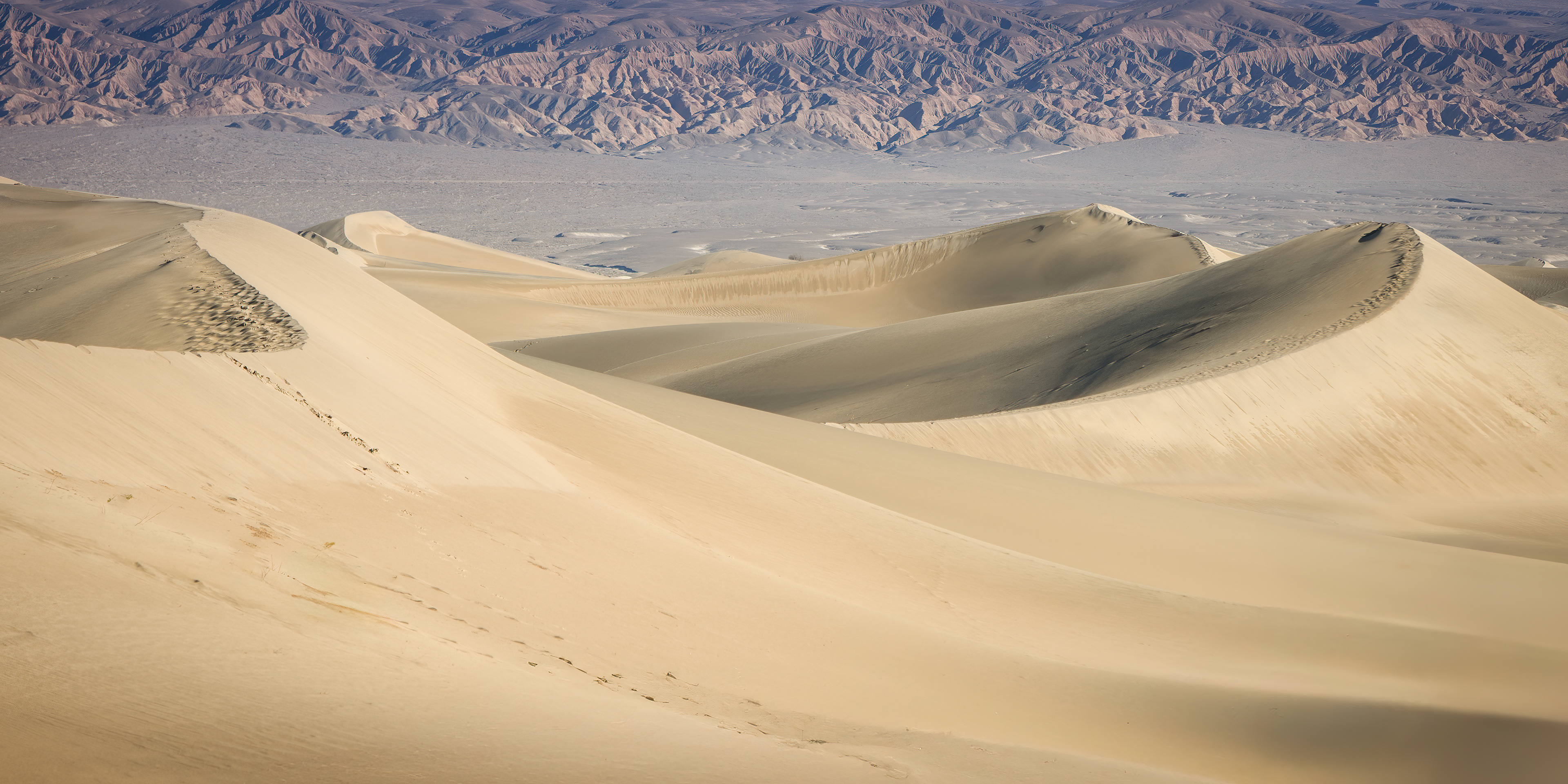
These are crescent-shaped Barchan dunes recognized by their unique "C" or half-moon form, featuring two "horns" or tips that point in the direction of the prevailing wind. These dunes typically develop in deserts with a limited sand supply and consistent wind patterns. The entire dune can shift in the direction of the wind that shapes it. ©Tom Dorsz

___________________________________________________
Badwater Basin
Badwater Basin is the lowest point in North America at 282 ft (86 m) below sea level and surrounded by some pretty tall mountains. The salt flats here cover nearly 200 square miles (518 square km), and are composed mostly of sodium chloride or table salt, calcite, gypsum, and borax. Yes, Borax, of the old laundry soap commercials. The road through it includes stops for bizarre names like: The Devil's Golf Course, Devil's Cornfield, The Artist's Palette, geometric salt polygons, and the plain salt flats. 
Devil's Golf Course
The Devil's Golf Course is a vast area of rock salt eroded by wind and rain into sharp, jagged formations. The landscape is so rugged that it's said, "Only the devil could play golf on such rough links." If you listen closely, you can hear sounds resembling tiny pops and pings; this noise comes from billions of tiny salt crystals bursting apart as they expand and contract in the heat.
• It's easily accessible by a short drive from Badwater Road and has a parking lot but no boardwalk or trail.
Caution: Devil's Golf Course's surface is made of jagged salt formations, making it difficult and potentially dangerous to walk on.
• The intense heat during the summer months can be particularly dangerous.

The incredibly immense Devil's Golf Course. The rock salt is sharp and very easy to lose your footing on. ©Tom Dorsz

Artists Palette
The Artist’s Drive winds through canyons and alongside the rugged Black Mountains, ultimately leading to the Artist’s Palette. At this scenic destination, you can admire a stunning array of colors—red, orange, yellow, blue, pink, and green—splashing across the hills. These vibrant hues result from volcanic deposits rich in compounds like iron oxides and chlorite, creating a beautiful rainbow effect.​​​​​​​ It really is a fantastic array of colors. It's one of those places where you want to walk and take it all in.

• 9 miles one way on Artist Drive. A lot of decent pullovers.
• There are several trails available, particularly at the Artists Palette parking area.

The nine-mile-long Artists Drive winds through impressive canyons alongside the rugged Black Mountains. 
©Tom Dorsz

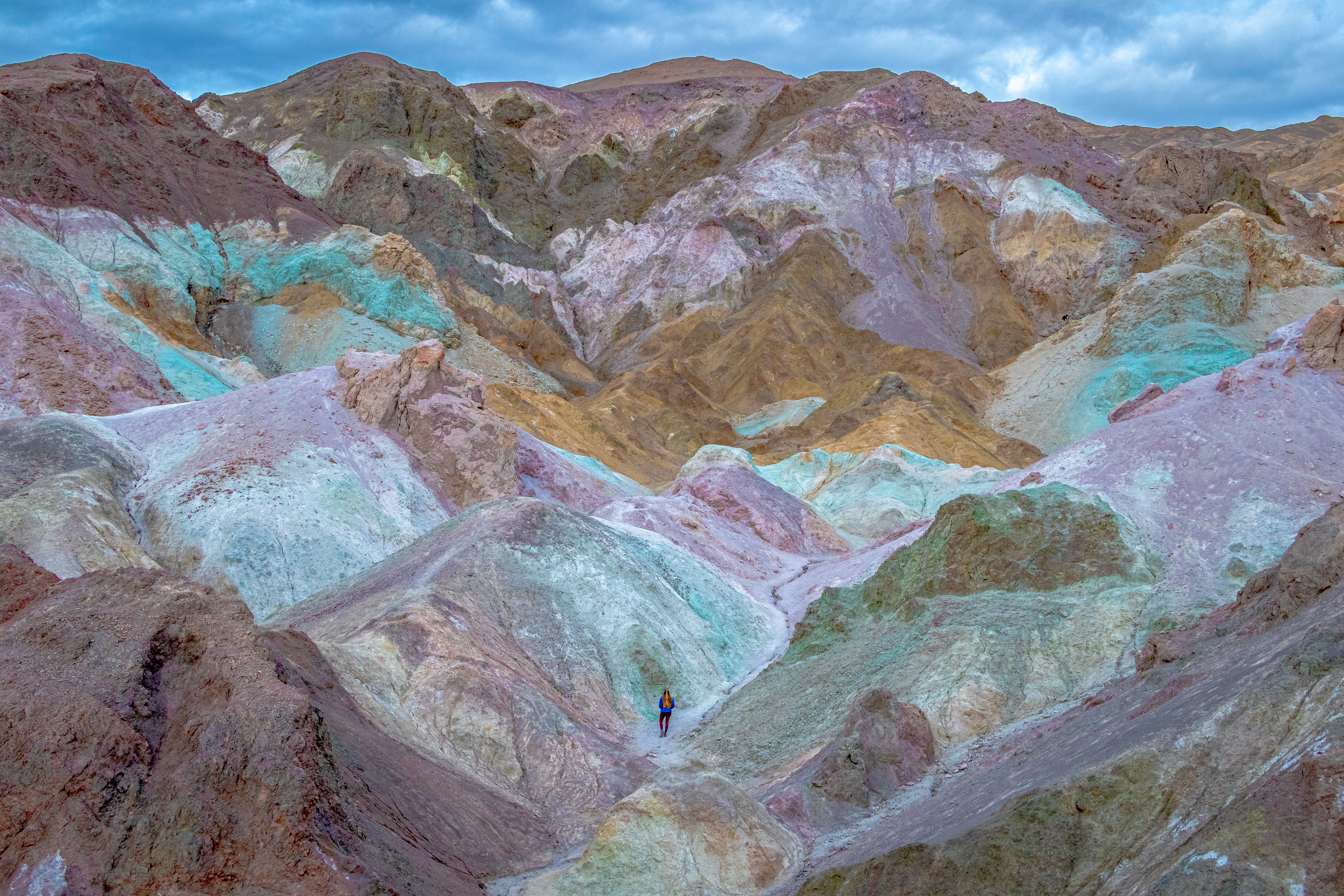
The destination is so worth it. Take the time to walk and explore the colors and topography. 
©Wirestock/Adobe

Devil's Cornfield
There are many challenges in Death Valley. Given how remote and unforgiving the environment is, it's easy to see why. At times, it feels as though you're on Mars, surrounded by a desolate landscape with little water. However, the cornfields provide a striking contrast, adding an interesting touch of green to this otherwise arid place.

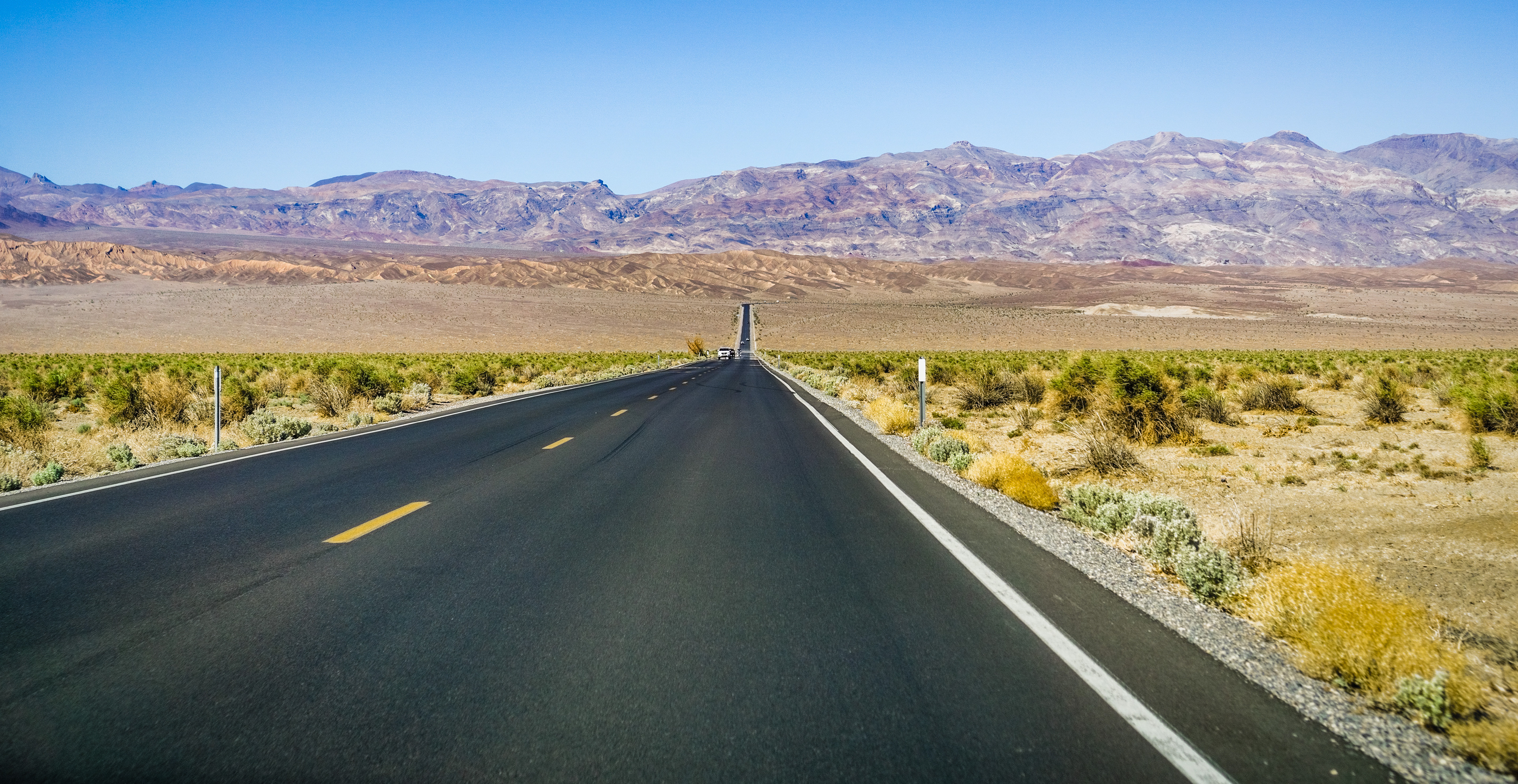
Arrowweeds, also known as Devil's Cornfield plants, grow on either side of Highway 190 in Death Valley National Park. ©Sundry Photography/Adobe

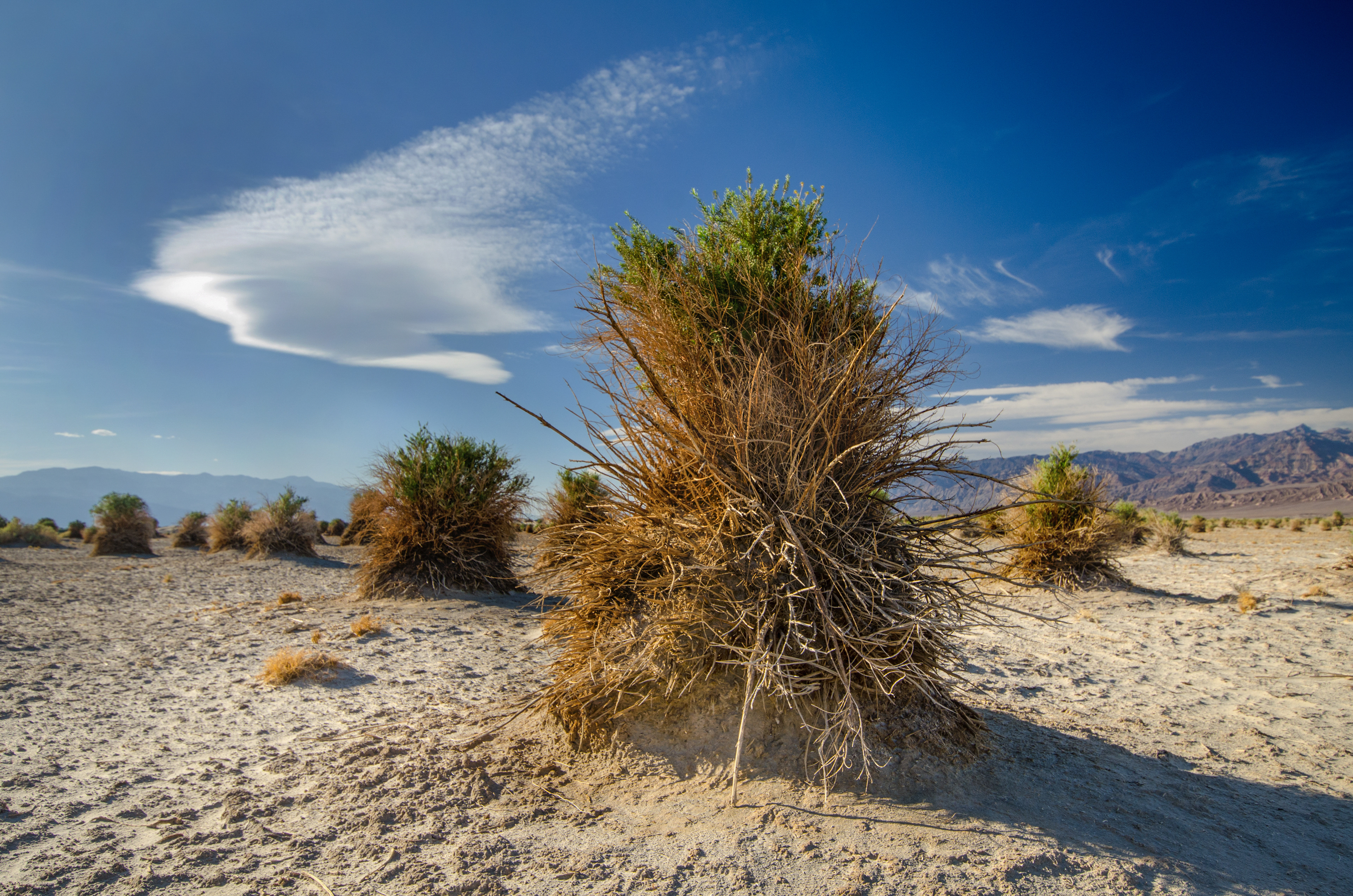
The plants in Death Valley's Devil's Cornfield are arrowweed. Despite the name, they are not corn. The name "Devil's Cornfield" comes from how these shrubs grow in dense, upright clumps, resembling harvested sheaves of corn. ©Terefere/Adobe

___________________________________________________
Pat and I left Death Valley and headed to Las Vegas—two places that couldn’t be more different! We enjoyed our brief visit to Death Valley and wish we had more time to explore the many fascinating spots in this vast desert landscape. We are truly grateful that we visited in winter; we can only cringe at the thought of the early non-indigenous explorers who braved this unforgiving place.
___________________________________________________
The links provided below are affiliate links, including those from Amazon. This website earns a commission on qualifying purchases made through these links. I only share products or services that I genuinely believe are helpful based on my own experience. Your support through these affiliate links helps keep this site running, so thank you!
___________________________________________________
Trekking poles are a must-have if you plan to walk on the dunes and the many rough trails throughout the park. 
For hiking trails and sand dunes, look for lightweight, durable, breathable boots with good ankle support and aggressive traction. Here's a good write-up on hiking boots
___________________________________________________

You may also like

Back to Top